HuntStand’s advanced mapping tools and powerful layers make us the #1 hunting and land management app in the country. HuntStand Pro takes these features to the next level with Real 3D, which allows you to fly through places you would like to explore virtually. Advanced layers enable you to access national databases that include public hunting land, tree coverage, satellite images, map markers and lines, and area measurements. Harvest information, weather, news feeds, group message boards, friend finder, and much more will make this your must-have hunting app. Make this hunting season your best season with HuntStand Pro!
Buy now at the exclusive Union Sportsmen's Alliance price of only $23.99 USD for your first year. That's 20% off!

HuntStand Pro Features
We believe that access to great information should be widely accessible and affordable. Upgrade to HuntStand Pro to unlock some amazing features and tools including:
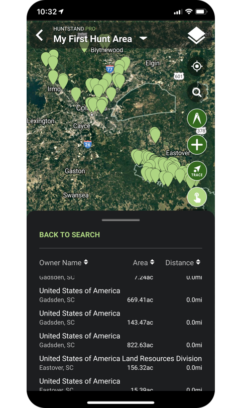
Advanced Property Search NEW
Searching out new hunting land? Trying to find that piece of property your neighbor said you could hunt on? Advanced Property Search is a very powerful new feature that allows you to easily search and view results in our entire nationwide ownership database.
- Search HuntStand's nationwide property database by owner name, address, county, state, acreage, proximity to the user and more.
- Users can also search for other parcels associated with the same owner and mailing address. This is particularly useful for identifying large tracts of land made up of numerous parcels under the same owner.
- Search results can be viewed on a map overlay, or in a list view.
- Save the boundaries of any result to your custom map or Hunt Area.
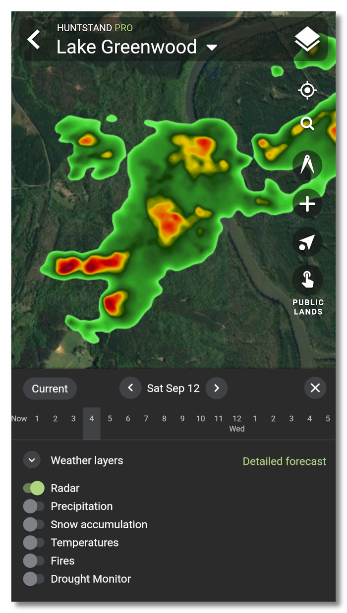
Weather maps
HuntStand now offers universal weather overlays showing current conditions and forecasts! These overlays will appear over any base layer and can be accessed through the weather icon in the bottom right hand corner of your screen (Android/IOS only). View current maps or forecasted maps hourly and up to 5 days out. Click on the “Weather Layers” popup to toggle layers on and off. Click on “Detailed Forecast” to view our traditional weather forecast screens.
Available weather overlays include:
- Radar
- Precipitation
- Snow accumulation
- Temperatures
- Fires
- Drought Monitor
- Learn more about Weather Maps
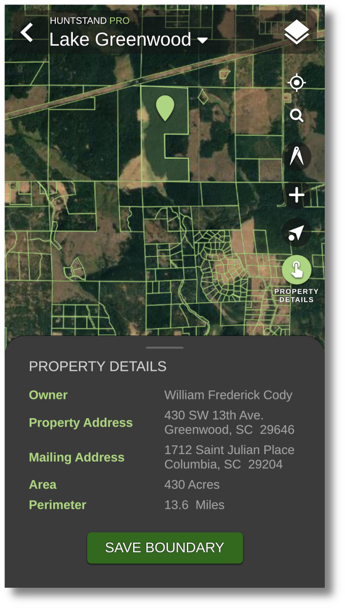
Nationwide Property Information for the U.S.
- High accuracy property boundaries
- Up-to-date owner name for private and public land parcels
- Property address
- Owner mailing address
- Property area and perimeter length
- Save and share boundaries
- Searchable by address or coordinates
- Property boundaries for much of Canada. See the coverage map below.
Monthly Satellite Imagery
A limitation of more traditional mapping layers has been their recency -- often updated only every 2-3 years, leaving a major blindspot for hunters and outdoor enthusiasts. HuntStand Pro offers a monthly satellite imagery layer which gives you an up-to-date view of your property. This layer is lower resolution than our traditional layers, but trades clarity for recency.
This feature is great for viewing:
- Timber thinning / clear cuts
- Fires and burns
- Flooding
- Agricultural activity
- Snow and ice cover
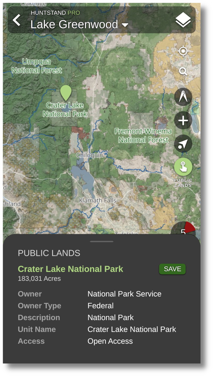
Public Lands
- Forest Service
- National and State Parks
- Bureau of Land Management
- U.S. and State Fish & Wildlife
- U.S. and State Department of Natural Resources
- Show more...
- *Not Available in Canada
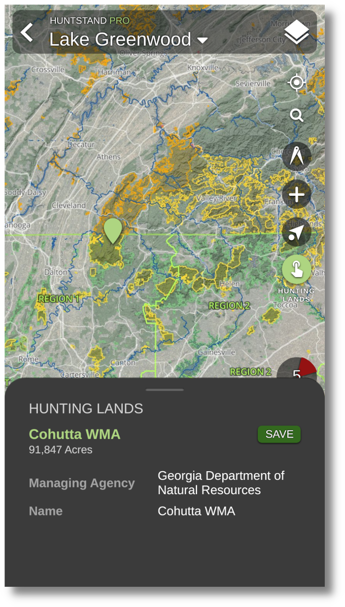
Hunting Lands
- Wildlife Management Areas
- Department of Natural Resources
- Department of Fish and Wildlife
- Game Management Units, Zones, and Districts
- Show more...
- *Not Available in Canada
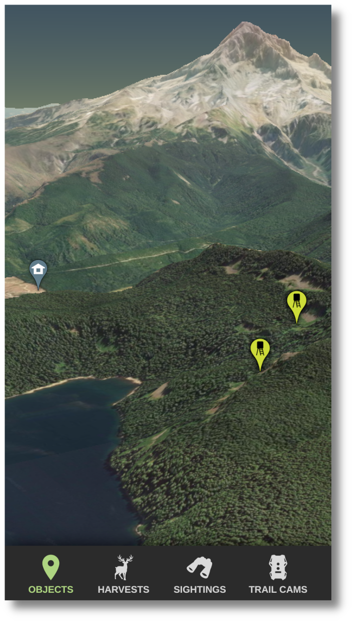
3D Mapping
- Dynamic interactive 3D maps
- High resolution Google Maps imagery
- High accuracy elevation model
- Available on iOS, Android, and Web
- Learn more about 3D Mapping...
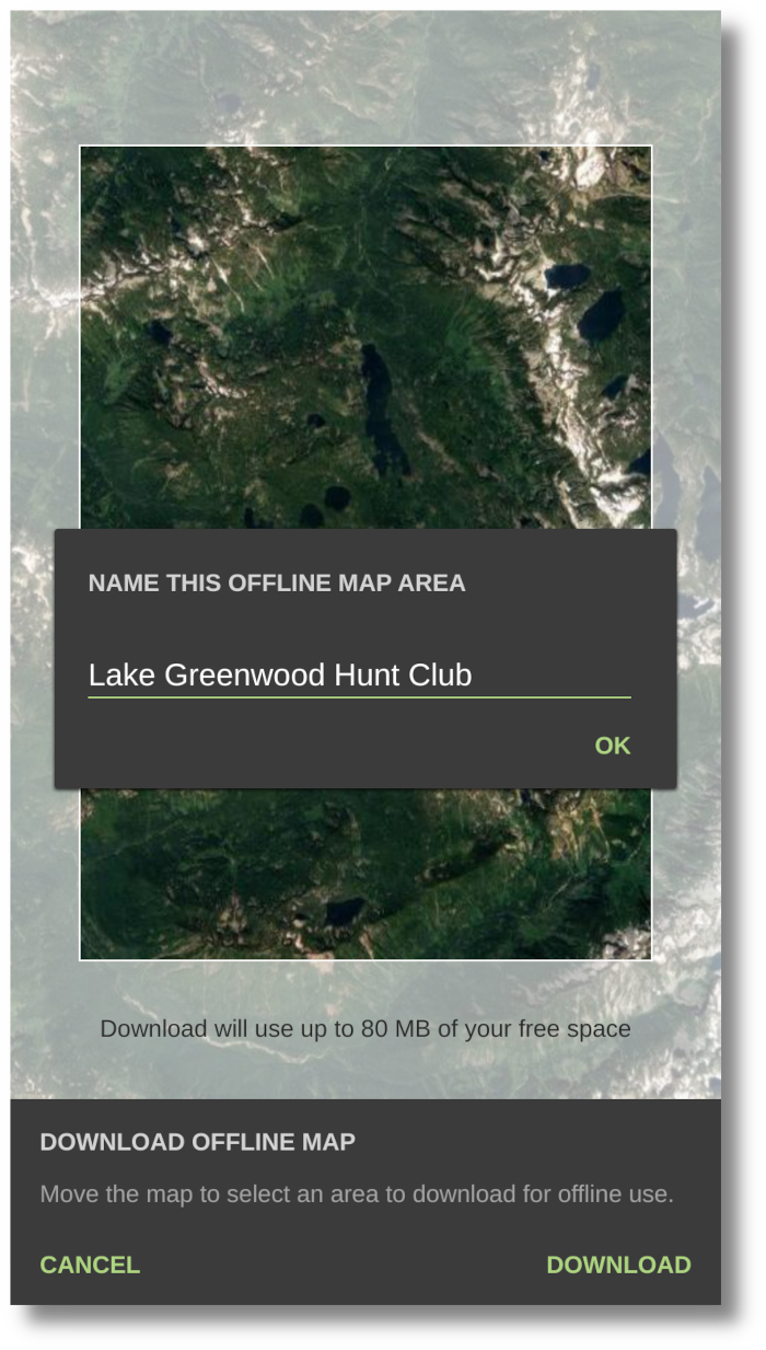
Offline Mapping
- High resolution offline satellite imagery
- Detailed roads and places overlay
- Contour lines
- Unlimited map downloads up to available device storage
- Store offline maps indefinitely, or refresh them often
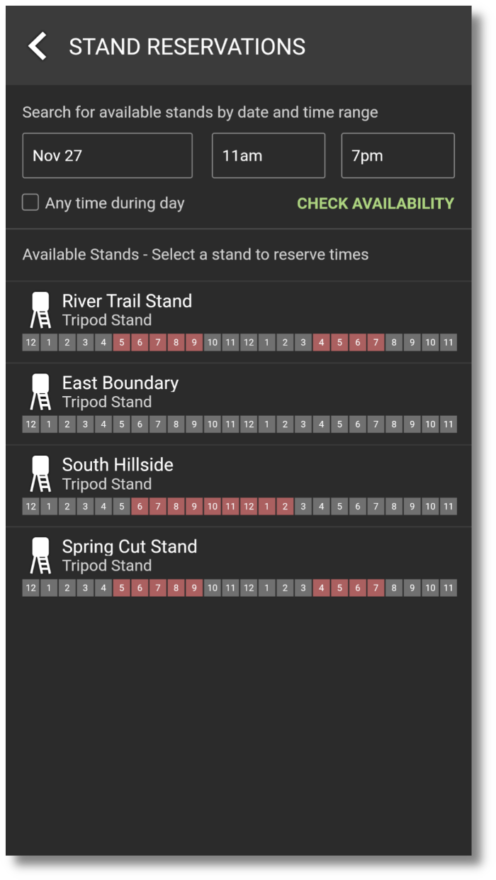
Stand Reservations
Use Hunt Area sharing to manage stand reservations on your property
- Search for available stands/blinds in a Hunt Area by date and time
- See what stands are occupied currently, and by whom
- See upcoming reservations for specific stands, or all stands in a group Hunt Area
- Manage stands in a group Hunt Area
- Manage reservations in a group Hunt Area
- Available on iOS and Android
- Learn more about Stand Reservations
TerraPulse Tree Cover
- Exclusive access to the most comprehensive tree cover and vegetation map ever offered to the public.
- This layer distinguishes between trees and other types of vegetation that support big game habitat suitability

Natural Atlas
The most comprehensive and accurate map of the United States' outdoors. trails, ATV and 4X4 roads, forest roads, campgrounds, parks, natural points of interest, access locations, and more.
- Trails
- ATV and 4X4 roads
- Forest roads
- Camgrounds
- Parks
- Natural Points of Interest
- Access Locations
- More
- *Not Available in Canada

MapBox Satellite
- Receive access to perfectly blended and color-corrected imagery from Mapbox, a global leader in technology.

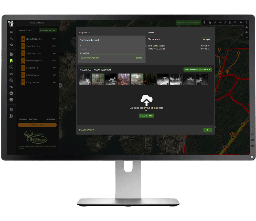
Trail Camera Pro
- 40GB of free storage space
- Automatic animal tagging using image recognition
- Detailed heatmaps of game activity and movement predictions
- Unlimited custom tags
- Learn more about Trail Camera Management
Ad Free
- Hide all the ads with a HuntStand Pro subscription for a streamlined in-app experience.

